Possible Points: 20 points for the element.
Purpose of Element: To encourage communities to map areas that perform one or more natural floodplain functions so they can be used by local officials and residents to make decisions. Examples of natural floodplain functions that could be mapped for credit include:
- Wetlands identified by the community or in the National Wetlands Inventory,
- Critical fish and wildlife habitat identified by the U.S. Fish and Wildlife Service,
- Sensitive habitat mapped by the state or a regional government entity,
- Areas credited for CRS element 422.c. Natural Functions Open Space,
- Areas identified in the community’s Natural Floodplain Functions Plan that is credited in element 512.c.
In order to earn credit for this element, one or more of these natural floodplain functions must be mapped by the community and information must be provided about floodplain functions that these areas provide.
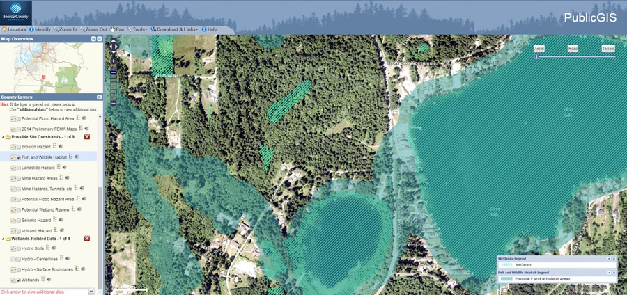
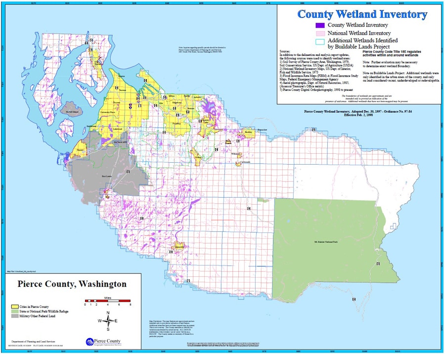
For example, a publicly available GIS mapping application for Pierce County, WA includes layers related to natural floodplain functions, specifically wetlands and fish and wildlife habitat. Pierce County, WA also produces a County Wetlands Inventory map that includes data from their own County Wetlands Inventory, as well as data from the National Wetlands Inventory, to provide a comprehensive picture of where wetlands are located within the county. Pictured below are both of these example maps. Since these wetland resources are identified and mapped, community leaders can make well-informed decisions to preserve, regulate, or steer development in other directions. For more information, see page 320-15 of the CRS Coordinator's Manual.
Impact Adjustment: None.
Potential to Double Count Credit: None.
Degree of Difficulty - Documentation: Low. To meet the documentation requirements for this element a community must simply keep accurate records.
Degree of Difficulty - Implementation: Medium. Creating the maps required to earn credit for this element will likely require the help of an individual that can work with a Geographic Information System (GIS). In addition, earning credit for element 322.a. Basic FIRM Information, is a prerequisite for earning credit under this element.
Helpful Tools and Resources:
1. NOAA's Digital Coast
2. Data.gov
3. Northwestern University's U.S. State Data Clearinghouse
Tip for Success:
- If your community does not have natural floodplain functions data of its own to map for this element, leverage publicly-available datasets.
Co-Benefits Associated with this Element: Once areas that provide natural floodplain function are mapped, communities can more easily apply regulations to them and make informed decisions about where new development should occur. These maps can also be useful to individuals. Natural floodplain functions provide critical habitat for wildlife, reduce the amount of sediments reaching water bodies by slowing down the velocity of the water as it travels overland and can improve air quality. In urban areas they can increase opportunities for infiltration and recreation.